Friday, July 26, 2013

Reached Nenana, Alaska

Thanks to the ladies of the Dawson City visitor center and Cadence Bicycles in Whitehorse, a new rear wheel was shipped to us.
After four nights in Dawson City, we continued cycling again. We rode the strenuous Top of the world highway to the Alaska border and Chicken. Via Tok we rode to the end of the Alaska highway in Delta Junction. The Richardson highway took us to North Pole and Fairbanks. We are now on the Parks highway heading south towards Denali National Park.
For sake of time and comfort we have decided on a reroute. We will not go north on the Dalton highway, but we will take the Denali highway to the east and then the Glenn highway back west to Anchorage.
Installing the new wheel

Top of the world highway

Back in Alaska

Camping in the wild near Dot Lake, AK

Delta Junction, Alaska

Always Christmas in North Pole, Alaska

The Nenana ice breakup tripod

Monday, July 15, 2013

Reached Dawson City, Yukon

The MV Malaspina of the Alaska Marine Highway transported us from Juneau to Skagway. Here we started cycling again, following the trail of the Klondike gold rush over the White Pass into Canada (first British Columbia, not much later the Yukon).
We rode the scenic South Klondike highway via Carcross to Whitehorse and took a swim in the Takhini Hot Spring.
On the way there we saw the first bear of our trip. Continuing north on the North Klondike Highway we saw another bear and two moose.
Via Carmacks and Pelly Crossing we made it to Dawson City.
Unfortunately we have to stay here a few days to arrange a new rear wheel for Fred because the rim has cracked.
Next highlight of our trip will be the Top Of The World Highway, taking us into Alaska again.
M/V Malaspina (Juneau, AK - Skagway, AK)

Back in Canada

S/S Klondike in Whitehorse, YT

Grizzly watching us go by

Rear wheel damage (Dawson City, YT)

Saturday, July 06, 2013

Reached Juneau, Alaska

From Victoria we cycled north on Vancouver Island, first following the east coast via Nanaimo and Courtenay to Campbell River. Then highway 19 lead us through more mountaineous terrain of the northern part of the island to Port Hardy.
The trip on Vancouver Island was memoriable. We've had some rain, but sunshine also. And we have camped at a few nice sites with views worth dying for.
In Port Hardy we boarded the MV Northern Expedition for the all-day trip to Prince Rupert. In the middle of the night we changed ships. The MV Taku of the Alaska Marine Highway brought us to Juneau, Alaska.
Tomorrow we will sail to Skagway, where we will start cycling again.
The ferry to Mill Bay (Vancouver Island)

Beautiful surroundings on north part of Vancouver Island

Morning reflections in Roberts Lake

Just-off-the-road campsite near Woss (Vancouver Island)

Wednesday, June 26, 2013

Reached Victoria, British Columbia

From Idleyld Park we continued to go west, back to the coast. At Reedsport we headed north on the 101, along the Oregon Sand Dunes. Luckily the wind was blowing from the Southwest, so it pushed us forward, where normally this time of year the wind is northwesterly. Unfortunately this wind also brought some rain. We followed the coast into Washington and to Olympic National Park's rainforest (which included the rain). In Port Angeles we boarded the MV Coho to Victoria, British Columbia, Canada.
Typical Oregon beach view

Crossing the 45th parallel

Crossing the Columbia river into Washington state

We're now in Washington state

M/V Coho (Port Angeles, WA to Victoria, BC)

Saturday, June 15, 2013

Reached Idleyld Park, Oregon

We are stille going strong, on our way to the Pacific Coast again.
Since Hat Creek we cycled between the lava flows in Lava Beds National Monument and we cycled on the rim of America's deepest and clearest lake in the caldera of Crater Lake National Park.
In between we left California and are now in Oregon.
The last few days, camping at high elevations, we woke up in very low temperatures, once even below zero. During the day, the weather has been pretty nice.
Today we descended the whole day towards the coast, which we will follow north towards Olympic National Park.
We're allowed to enter (Lava Beds NM)

Lava rocks in Lava Beds NM

Agricultural scenery

The lake of Crater Lake NP

The lake of Crater Lake NP

Sunday, June 09, 2013

Reached Hat Creek, California

After Clearlake we descended into the Central Valley again, first to the west to Colusa, then to the north to Chico.
Then the temperatures started tot rise tot record values, just as we had tot climb out of the valley again towards Lassen Volcanic National Park. But we succeeded and this morning we went over the highest point in the park (2594 m), with snow still piled up along the way.
The spectacular views on the volcanic mountain peaks made good for all the hard work and sweat.
Next special place tot visit will be Lava Beds.
Volcanic activity in Lassen Volcanic NP

Posing with Mt. Lassen

Perpetual snow in Lassen Volcanic NP

Perpetual snow in Lassen Volcanic NP

Volcanoes of Lassen Volcanic NP

Wednesday, June 05, 2013

Reached Clearlake, California

Our apologies it took so long to write thiees post. We did not have WiFi available.
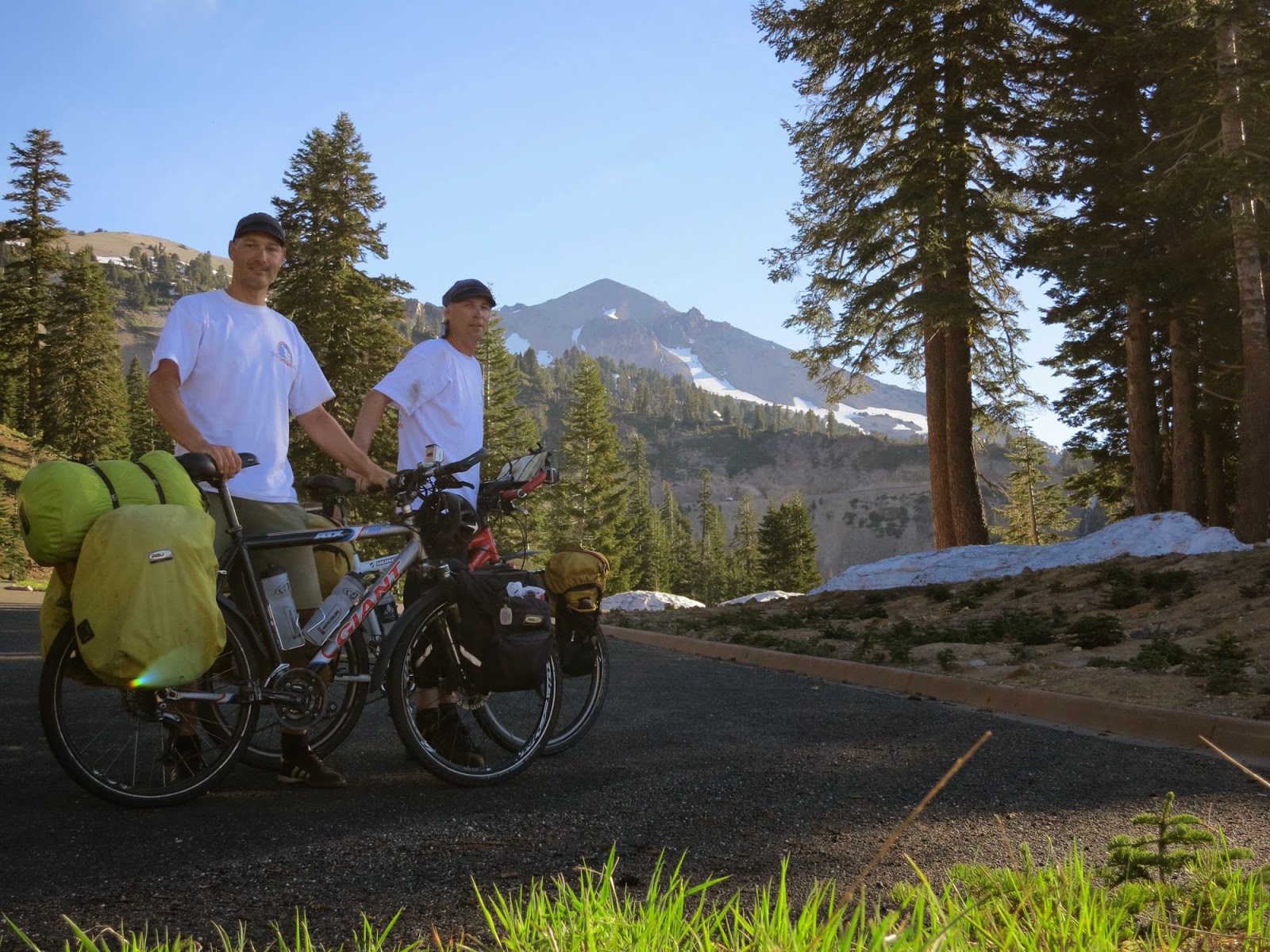
Since our previous post we have done 876 km through many different types of scenery. From Mammoth Lakes we continued north to Lee Vining, where we started to climb to Tioga Pass (9945 ft), also the entrance of Yosemite National Park. We crossed this beautiful park to the west side, encountering the first bit of rain on our trip. We traversed the Sierra foothills, the dry grassy plain of California's Central Valley and the coastal mountains to Santa Cruz on the Pacific coast. We then followed the coast to San Francisco, over the Golden Gate bridge, to Bodega, where we turned inland again to Santa Rosa and today, over some very steep hills, to Clear lake.
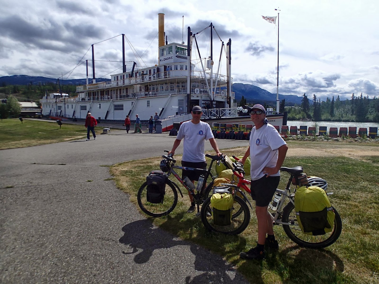
On our way we meet lots of nice and interesting people, always willing to help us, for instance escorting us on bicycle to the campground in town.
Now we head northeast, again into the Central Valley, towards Lassen Volcanic National Park. Unluckily for us temperatures are rising above 30°C again. We preferred the cooler weather at the coast.
Climbing Tioga Pass

Tioga Pass (9945 ft.), entrance to Yosemite NP

Sierra Nevada foothills, California

Golden Gate bridge, San Fransisco

Cycling over the Golden Gate bridge

Camping on the cliffs of the Pacific ocean

Steep climbs in the California coastal mountains

Sunday, May 26, 2013

Reached Mammoth Lakes, California

The day after our previous post we entered Death Valley National Park. Starting early in the morning, when it was still relatively cool, we climbed Salsbury Pass (1010 m) to the park boundary, followed by a long downhill, a hop over Jubilee Pass (390 m) and a further downhill to the Badwater Valley. There we were confronted with a stormy headwind, which made our progress slow and exhausting. We passed by the lowest point of the USA, Badwater basin (-86 m) and camped in Furnace Creek. We continued through the park to Stovepipe Wells, passing by the Mesquite Sand Dunes. Climbing out of the park over the two high and steep passes turned out to be too strenuous and after staying a night in Stovepipe`s motel, we accepted a ride to Lone Pine, where the temperature was more comfortable for cycling. We headed north on the US395, via Bishop to Mammoth Lakes with a beautiful scenery of the Sierra mountains on our left.
Entering Death Valley National Park

Badwater Basin (Death Valley NP)

Escaping the heat in Stovepipe Wells (Death Valley NP)

Owen Valley, California

Owen Valley, California

Monday, May 20, 2013

Reached Shoshone, California

After a long flight we arrive in Las Vegas at night. After assembling our bicycles we cycle to a nearby hotel. The next morning we cycle along the famous Las Vegas strip. We then head towards Pahrump. From Las Vegas we have a big climb to the top of the Spring Mountain Pass of 5500 feet. Just after this pass we pick a place in the middle of the desert to pitch our tent in the wild. We notice a small rattle snake just passing near our campsite. Next morning we depart early and cycle through Pahrump to Shoshone. We now left Nevada and are now in California. We now have cycled 152 km in these two days.
The Strip in Las Vegas

The Las Vegas welcome sign

Into the Nevada desert

Friday, March 14, 2008

Een foto van onze fietstocht door Nieuw Zeeland


Nederlands, English


Here a little photo from our New Zealand bicycle trip.


Hier een kleine foto van onze Nieuw Zeeland fietstocht.
Posted by Picasa